Nickers!!!

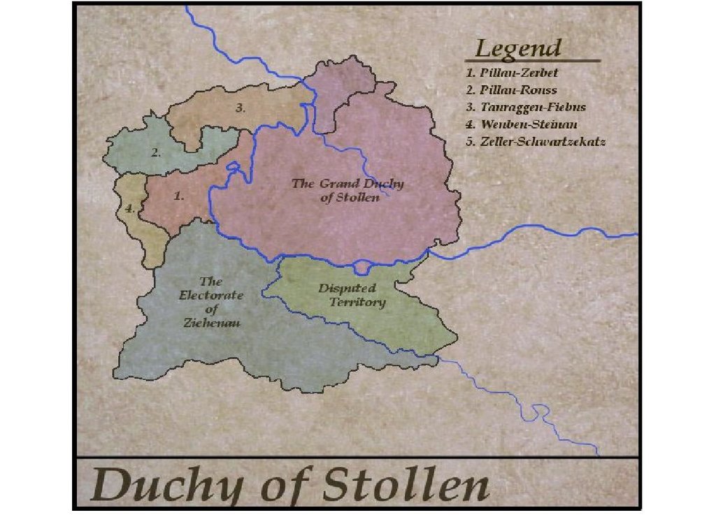
Gotcha! You should be ashamed. All kidding aside, it seems my previous campaign maps have captured the imaginations of others. Good! It's flattering to learn that my own doodlings have inspired others to modify something first put out there into cyberspace by yours truly.

With that in mind, look what I found over at the OSW group this morning. Relative to an ongoing discussion there about mapmaking and the associated software Campaign Cartographer, Tyler Provick has been experimenting with different graphics and mapmaking software. He has posted the results of his work in a folder at OSW in the "Files" section.

Imagine my surprise, when the first map I opened turned out to be a later version of the map I dreamed up this summer and finally committed to paper while camping three weeks ago! I must say, I like the look of Tyler's map. His version is suitably "antique" looking although I am partial to the brighter colors I acheived with colored pencils and MS Paint. Still, Tyler's version of the map is impressive in its own right, and I applaud his efforts. Well done Tyler!

Now, I wonder if I can get Tyler to agree to complete the map for me using Campaign Cartographer? You know, all those lakes, cities, towns, and the names of surrounding historical entities -- plus the much coveted compass rose in the upper left-hand corner of the map! ;-)

Comments

Bluebear Jeff said…
I also liked this version of the map when I saw it on the OSW group site.

I personally use GameMapr. I downloaded a demo of Campaign Cartographer and found it too complex for my needs.

I think Tyler said that he used two free programs, Gimp and Inkscape, to create this map . . . and it looks very good to me.


-- Jeff

http://saxe-bearstein.blogspot.com/
MurdocK said…
I actually like the 'texture' of the background and think that the colors are just right for the time period. Remember that most inks and dyes were natural since the chemistry of color was not really understood, nor in mass production until about 1850.

Popular posts from this blog

And We're Off!!!

  Arrrgh!  Gotta go back into camera settings on my iPhone to bring all of the frame into focus.  Blast! Painting is underway on the 60 or so Minden Austrians, which are slated to become my version of the Anhalt-Zerbst Regiment of AWI renown.  More or less indistinguishable from Austrians of the era really, right down to the red facings and turnbacks, but the eventual flags (already in my files) will set them apart.   I went ahead and based-coated all of them over a couple of days lthe last week of August, using a mix of light gray and white acrylic gesso, before next applying my usual basic alkyd oil flesh tone to the faces and hands.  In a day or two, I'll hit that with Army Painter Flesh Wash to tone things down a bit and bring some definition to the faces and hands.   As usual, the plan is to focus on about 20 figures at a time, splitting the regiment roughly into thirds along with the color party and regimental staff.  Depending on ...

The 18th century? What's the Fascination?

Hessian musketeers by All the King's Men Toy Soldiers of Snellville, Georgia, U.S.A. Just a quick post post today, but I thought the above question might be interesting food for thought. Obviously, there is an array of possible periods, theaters, and conflicts that might catch our eyes. But what is it about the era 1700-1799 -- either real, or imagined? Is it the commanders and politics? The fairly straightforward tactics? The myriad of uniforms and flags? The variety and scope of the conflicts? The patchwork of various and sundry petty states, (at least in Central Europe)? I'm very interested to learn your thoughts. Don't be a lurker! Please leave a comment -- or even two or three. Have a nice day everyone!

Sunday Morning Coffee with AI. . .

    A rmed with a second cup of fresh, strong coffee, I messed around a bit this morning with artlist.io using its image to image function in an attempt to convert my hand-drawn map from September 2006 to something that more resembles an old map from the mid-18th century.  And just like my experiments with Ninja AI in June, the results are mixed.   The above map is pretty good, but Artlist keeps fouling up the place names and has trouble putting a faint overlay of hexes across the entire area.  Hexes, admittedly, are not likely to be found on any genuine maps from the era in question, but there we are.  Frankly, I prefer the appearance of the Ninja map, but there were problems getting it to correct its errors.  Grrrr.  As is the case with so much having to do with the various AI's out there now, the output generated is a direct result of the prompts entered.  For text alone, and when you develop a lengthy, highly detailed prompt, it is...